Map - Kadiogo Province (Kadiogo Province)

Kadiogo Province (Kadiogo Province)
Kadiogo is a province of Burkina Faso, located in its Centre Region. Its area is of 2,805 km2, containing six departments and a population of 3,032,668 (2019). Its capital is also the state capital, Ouagadougou. It features the central plateau of the country. It is highly urbanized and is both the most populated and the most densely populated province.

Kadiogo is divided into seven departments:

 
Map - Kadiogo Province (Kadiogo Province)
Map
Openstreetmap - Map - Kadiogo Province
Openstreetmap
Map - Kadiogo Province - Esri.WorldImagery
Esri.WorldImagery
Map - Kadiogo Province - Esri.WorldStreetMap
Esri.WorldStreetMap
Map - Kadiogo Province - OpenStreetMap.Mapnik
OpenStreetMap.Mapnik
Map - Kadiogo Province - OpenStreetMap.HOT
OpenStreetMap.HOT
Map - Kadiogo Province - CartoDB.Positron
CartoDB.Positron
Map - Kadiogo Province - CartoDB.Voyager
CartoDB.Voyager
Map - Kadiogo Province - OpenMapSurfer.Roads
OpenMapSurfer.Roads
Map - Kadiogo Province - Esri.WorldTopoMap
Esri.WorldTopoMap
Map - Kadiogo Province - Stamen.TonerLite
Stamen.TonerLite
Country - Burkina_Faso
Flag of Burkina Faso
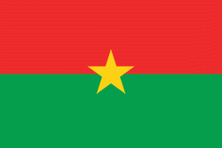
Burkina Faso (, ;, ??????? ????) is a landlocked country in West Africa with an area of 274200 km2, bordered by Mali to the northwest, Niger to the northeast, Benin to the southeast, Togo and Ghana to the south, and the Ivory Coast to the southwest. As of 2021, the country had an estimated population of 20,321,378. Previously called Republic of Upper Volta (1958–1984), it was renamed Burkina Faso by President Thomas Sankara. Its citizens are known as Burkinabès, and its capital and largest city is Ouagadougou. Its name is often translated into English as the "Land of Honest Men".

The largest ethnic group in Burkina Faso is the Mossi people, who settled the area in the 11th and 13th centuries. They established powerful kingdoms such as the Ouagadougou, Tenkodogo, and Yatenga. In 1896, it was colonized by the French as part of French West Africa; in 1958, Upper Volta became a self-governing colony within the French Community. In 1960, it gained full independence with Maurice Yaméogo as president. Throughout the decades post independence, the country was subject to instability, droughts, famines and corruption. Various coups have also taken place in the country, in 1966, 1980, 1982, 1983, 1987, and twice in 2022, in January and in September, as well as an attempt in 1989 and another in 2015.
Currency / Language  
ISO Currency Symbol Significant figures
XOF West African CFA franc Fr 0
ISO Language
FR French language
Neighbourhood - Country  
  •  Benin 
  •  Côte d'Ivoire 
  •  Ghana 
  •  Mali 
  •  Niger 
  •  Togo 
Administrative Subdivision
City, Village,...
Airport